
18 Best Atlas Books
The best atlas books, ranked by how many expert sources recommend each one, with notes to help adults, students, and curious travelers choose a useful map book.
Our take
An atlas can answer a quick question about a place or give you a reason to spend an hour exploring it. These books range from detailed world references to illustrated introductions for children, historical maps, and guides to the geography of food and drink. The right choice depends on whether you want to locate places, understand patterns, or discover somewhere unfamiliar.
For general reference, Oxford, National Geographic, Collins, and The Times differ in format, level of detail, and the amount of explanation around their maps. Check the edition before buying, since borders, place names, and statistics change. History of the World Map by Map uses geography to explain events, while Atlas Obscura is better for browsing unusual destinations. The coffee, whisky, wine, and beer atlases focus on how place shapes what people produce and enjoy. Start with a general world atlas for lookups, a student edition for learning map skills, or a specialist volume tied to an interest you already have.
18 books · 9 sources · Last updated
As an Amazon Associate, we earn from qualifying purchases (at no extra cost to you).
How to choose from this list
Skip to the full rankingIf you want a household reference: Oxford Atlas of the World
If you want detailed regional maps: The Times Comprehensive Atlas of the World
If you're teaching a young map reader: Beginner's World Atlas → Student World Atlas
If you want history through geography: History of the World Map by Map
If you want unusual places to explore: Atlas Obscura
If you want to understand wine regions: The World Atlas of Wine
The 18 books, ranked
Ranked by how many expert sources name each book. Ties go to the book more people recommend.

National Geographic Atlas of the World
For households that want detailed cartography with photographs and explanations of global patterns. It offers more reference depth than the family edition, but its large format and small labels make casual handling less convenient.
What it's about
The eleventh edition of National Geographic's world atlas maps countries, regions, and oceans while examining population, environmental, and economic patterns. Country facts and flags accompany the cartography, and an extensive place-name index helps readers locate features across the globe.

Oxford Atlas of the World
For adults who want a general reference with maps and thematic context in one volume. Its broad coverage suits regular consultation, though this listed edition is older than the annually revised versions now available.
What it's about
Oxford’s twenty-eighth edition combines regional and city maps with satellite imagery and reference information on nations. Thematic sections explore subjects such as climate, population, energy, biodiversity, and global health, while a special feature examines human migration.

For curious travelers who want unusual destinations and stories to browse. It encourages exploration more effectively than a conventional place index, but it isn't a systematic atlas for checking borders, distances, or every country's geography.
What it's about
Joshua Foer, Dylan Thuras, and Ella Morton assemble a guide to unusual places around the world. Photographs, maps, and descriptions introduce natural wonders, architectural oddities, and overlooked cultural sites, emphasizing curiosity and discovery beyond familiar tourist destinations.
Also recommended by
1 person Adam Savage recommended this book
Adam Savage
"Buy the book. Seriously great content." - Adam Savage
Adam Savage's recommendation of this book

Collins World Atlas
For readers who want a compact household reference rather than a large display volume. Country facts and time zones support quick lookups, but the paperback format offers less room for detailed regional mapping.
What it's about
Collins presents world maps with country statistics, flags, and time zones in a paperback atlas. Its coverage and place-name references provide a compact geographical resource for family use, study, and business reference.
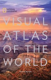
National Geographic Visual Atlas of the World
For readers choosing an atlas to browse slowly or leave open on a table. Photography and cultural landmarks give it more visual variety than a conventional reference, but its weight makes it awkward to carry.
What it's about
Maps, satellite imagery, and photographs introduce the world's natural and cultural landscapes. Coverage ranges from space imagery to World Heritage Sites, combining geographical reference with a visual survey of places that invite closer exploration.

The Times Comprehensive Atlas of the World
For map enthusiasts who prize detailed regional coverage and an extensive place index. It's a stronger choice for close consultation than light browsing, but this older edition needs checking against newer mapping for political changes.
What it's about
The fourteenth edition presents detailed maps of the world alongside geographic reference material and an extensive place-name index. Illustrated sections examine climate change, economic activity, and energy, with an additional feature exploring the power and uses of maps.
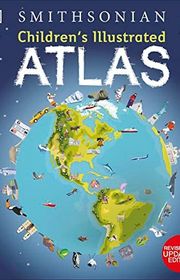
Children's Illustrated Atlas
For primary school children who enjoy pictures, icons, and short facts alongside maps. It makes map keys and scale approachable, though the busy illustrated pages suit exploration better than precise geographical reference.
What it's about
Illustrated maps introduce children to countries, cultures, wildlife, landmarks, and landscapes. Photographs and short facts add context, while explanations of keys, compass directions, and scale help young readers begin using maps for themselves.

For readers who remember history better when they can see where events happened. Maps make migrations, trade routes, and campaigns easier to follow, but the broad sweep leaves less space for competing historical interpretations.
What it's about
This visual world history uses maps to explain migration, trade, conquests, and the rise and fall of empires. Images, timelines, and concise accounts connect events across ancient, medieval, and modern periods, showing how geography and movement helped shape societies.
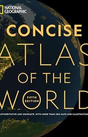
National Geographic Concise Atlas of the World
For readers who want a manageable reference between a student atlas and a large hardcover. It combines country maps with thematic coverage, though the reduced space means fewer regional details than the flagship atlas.
What it's about
Political and physical maps cover the world, continents, and the United States, alongside country facts and flags. Thematic graphics explore population, climate, health, and economics, while a space section extends the coverage beyond Earth.

Student World Atlas
For middle and high school students ready to compare physical, political, and thematic maps. It teaches geographic patterns more directly than an adult reference atlas, though it won't match the large volumes for local detail.
What it's about
Designed for middle and high school students, this atlas combines political, physical, and thematic maps with photographs, facts, charts, and infographics. Its sixth edition introduces countries and continents through geographic patterns and issues that connect places with the people living there.

Family Reference Atlas of the World
For families who want to connect locations with climate, migration, and daily life. Its explanations invite shared browsing more readily than a dense reference atlas, though specialists will want finer cartographic detail.
What it's about
This family atlas combines country maps, flags, statistics, and explanatory graphics with material on the oceans and space. Thematic sections examine subjects such as climate, migration, languages, and digital connectivity, helping readers connect individual places with broader geographic patterns.
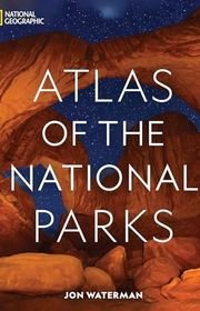
National Geographic Atlas of the National Parks
For readers planning broad explorations of America's national parks or enjoying them from home. Maps, ecology, and history give trips context, though the large book and older park count limit its usefulness as a current trail guide.
What it's about
Jon Waterman explores America's national parks through maps, photographs, and accounts of their landscapes, wildlife, and history. The 2019 volume covers 61 parks, offering an overview of their distinctive environments rather than detailed walking directions.
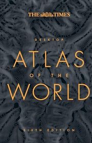
The Times Desktop Atlas of the World
For readers who want the Times mapping style in a volume that fits a normal desk. Its regional maps and reference facts support everyday use, though it sacrifices the fine detail of the Comprehensive atlas.
What it's about
This compact atlas combines political and regional maps with country flags, statistics, and geographical facts. Thematic maps examine topics including population, climate, and communications, while a place-name index supports quick reference across the world.

The World Atlas of Coffee
From Beans to Brewing -- Coffees Explored, Explained and Enjoyed
For coffee drinkers who want to connect flavor with growing regions and processing. It links origin and technique more usefully than a general geography book, though reading about brewing can't replace tasting and practice.
What it's about
James Hoffmann explores the factors shaping coffee's flavor, from varieties and growing conditions to harvesting, processing, roasting, and brewing. A country-by-country survey connects regional characteristics with the production methods behind coffees from around the world.

For whisky drinkers who want to explore regions and find related flavor styles. The distillery profiles turn geography into a useful tasting framework, but production details and available bottlings can change after publication.
What it's about
Dave Broom maps the whisky world through regional histories, distillery profiles, and tasting notes. This revised edition covers Scotland, Ireland, Japan, North America, and other producing regions, grouping whiskies by flavor to help readers connect geography, production, and style.

The World Atlas of Wine
For wine learners who want to understand how vineyards and regions fit together. Detailed maps make place central to the explanation, though beginners may need to look up unfamiliar grape varieties and wine terminology.
What it's about
Hugh Johnson and Jancis Robinson map the world's wine regions and explain the geography behind their wines. This edition combines detailed cartography with revised regional coverage, photographs, infographics, and discussion of climate change and wine economics.

For children learning what maps mean before they need a dense reference book. The large maps and photographs make an inviting introduction, though older students will soon want the greater detail of Student World Atlas.
What it's about
National Geographic introduces geography to young readers through large maps, photographs, and facts about land, people, and animals. Explanations of map keys, a glossary, and a conversion chart support early map-reading skills.

For beer drinkers curious about regional styles and brewing cultures beyond familiar brands. It gives broader international context than a simple tasting guide, but the changing brewery scene means some practical details will date.
What it's about
Tim Webb and Stephen Beaumont survey beer country by country, explaining regional brewing traditions, techniques, and styles. Maps show developments in major brewing territories, while practical features cover food pairings and serving different types of beer.
Sources
- 1
The Best World Atlases in 2026 - Vivid Maps
vividmaps.com
- 2
27 Best World Atlases For Map Lovers In 2026 - Brilliant Maps
brilliantmaps.com
- 3
Best World Atlas Book 2026: 8 Atlases Compared | Prettybooks
prettybook.com
- 4
Geography Buying Guide: Best World Atlases Compared (2026) | Loconymia
loconymia.com
- 5
Best World Atlas Maps
bestreviews.com
- 6
Which Atlas should I buy?
reddit.com
- 7
Best World Atlas Books: 9 Picks Compared | Mappr
mappr.co
- 8
Atlases And Maps
goodreads.com
- 9
Recommendation Needed for a Comprehensive World Atlas
reddit.com




Edited by
Software engineer whose passion for tracking book recommendations from podcasts inspired the creation of MRB.
Lead investor at 3one4 Capital whose startup expertise and love for books helped shape MRB and its growth.
Comments
Spotted a missing book, a wrong order or a mistake? Tell us and we'll fix this page.
We're a reading guide, not the author or publisher, so we can't send books or pass on messages.